Introduction to Mastering Naver Map: Advanced Features and English Navigation Tips
If you want to avoid feeling utterly lost and bewildered, truly understanding its nuances isn’t just helpful, it’s absolutely essential for a smooth trip. Honestly, Naver Map really is your digital lifeline here. Naver Map isn’t just an app; it’s practically a legal requirement for anyone navigating Korea, especially for visitors who need to find their way around public transport and those incredible hidden gems.
Why Naver Map is Non-Negotiable for Your Korean Journey
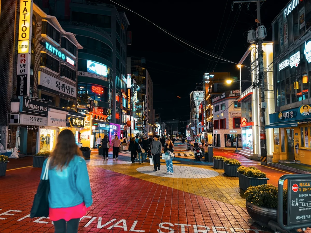
When I first visited Seoul, honestly, I tried using Google Maps, and it was a complete nightmare for public transport – buses just weren’t showing up correctly. I still remember nearly missing a train because of it, standing there completely confused by the bus stop signage, feeling the chaotic energy of the Seoul Station area wash over me. That’s when I grudgingly switched to Naver, and everything just… clicked. It’s not a legal requirement, of course, but for any sensible traveller, it might as well be. You know, why stumble when you can glide? This isn’t about mere convenience; it’s about navigating a country where local mapping data is king. Google Maps just doesn’t have the granular detail or the real-time accuracy that Naver Map does, especially for buses and those wonderfully intricate alleyways. Every expat and savvy traveller will tell you the same thing: Naver is the answer. It truly matters because without it, you’re constantly fighting against missing information, which, let’s be honest, nobody wants on holiday.
The Core Difference: Korean Context and Unmatched Data
I mean, the thing is, Naver Map lives and breathes Korea. It understands the intricate bus routes, the underground passages, the little shortcuts that Google Maps just doesn’t register. I’ve often wondered why exactly Google’s data is so sparse here, but I guess it boils down to local regulations and data sharing. It’s just how it is. Naver has integrated itself so deeply into the Korean infrastructure that its accuracy is frankly unmatched. This deep integration means its information on public transit, walking paths, and even specific shop locations is consistently reliable, reflecting the dynamic nature of Korean cities. This precision is vital, especially when you’re trying to find a specific restaurant tucked away in a tiny side street, or a particular exit from a sprawling subway station like Gangnam Station during rush hour. The app offers comprehensive details right down to elevation changes and indoor maps for major buildings, which, you know, is incredibly useful. It’s not just about getting to a street address; it’s about getting to the exact door.
Getting Started: A Quick Overview to English Navigation
My first attempt with Naver Map was a bit clunky, I admit. The Korean interface initially made me sweat, but then I found the language settings, tucked away in a corner – a real lifesaver. You know, that relief, seeing everything switch to English, was immense. It instantly transformed a confusing array of Hangul into something manageable, allowing me to focus on the actual navigation rather than translation. Download the app, find the settings (usually represented by three horizontal lines or a cog icon), and switch the language. Getting started is surprisingly straightforward once you know where to look. Fun fact: it makes a world of difference.
- Download the Naver Map app from your app store (available on iOS and Android).
- Open the app and look for the settings icon (often three lines or a cog in the top left or right).
- Navigate to Language Settings and select English.
- Start by searching for a well-known landmark, like N Seoul Tower, just to get a feel for the interface.
How to enjoy Mastering Naver Map: Advanced Features and English Navigation Tips
Enjoying Naver Map isn’t about rote learning; it’s about exploring its clever features, which essentially transform your travel experience from frustrating fumbling to seamless discovery. Think of it as uncovering little digital treasures that make navigating even the most complex Korean cities a genuine pleasure, not a chore. It really just makes things easy.
Unlocking Public Transport Mastery: Buses and Subways Made Simple
I still remember the first time I confidently hopped on a bus in Busan, thanks entirely to Naver Map. I typed in my destination, and it didn’t just give me the bus number, but also the real-time arrival of the next two buses, complete with their current location on the map. The sense of control, you know, it was amazing. No more guessing if a bus was coming or which direction it was heading; the vibrant map showed me everything, even the subtle sway of the bus on the screen, reflecting its actual movement. The slight vibration as the actual bus pulled up to the stop, it just confirmed the app’s accuracy. The processing times for route calculations are almost instantaneous, whether you’re connected to Wi-Fi or using mobile data, though, of course, data is usually quicker. It also provides optimal transfer points, telling you which subway car to board for the quickest exit or transfer, which can save precious minutes in a bustling station like Jamsil. This real-time information is a game-changer, especially for buses where routes can seem baffling from a tourist perspective.
- Enter your destination, then select the bus or subway icon for public transport options.
- Observe the real-time bus locations and estimated arrival times, sometimes displayed in bold.
- Look for specific transfer tips, such as “board the first car for quickest transfer”.
- Use the “current location” feature to track your journey and know when to alight.
Saving Your Favourite Haunts: Building Your Personal Korean Travel Guide
One feature I absolutely adore, and honestly, use almost religiously, is the ‘bookmark’ function. I created a list called ‘Seoul Eats’ and another for ‘Hidden Cafes’. It’s so handy to just pull up a map and see all my favourite spots twinkling like little stars. I mean, my friends occasionally ask for recommendations, and I just share my Naver Map list, simple as that. Around 30 spots are on my current ‘Gangnam Goodies’ list, all meticulously categorized. The colours I use for markers – green for cafes, red for restaurants – make everything so visually appealing, a true feast for the eyes. Whether it’s that fantastic BBQ joint you stumbled upon in Hongdae or a serene temple you found near Gyeongbokgung Palace, saving it ensures you can revisit it, or share it with others. This isn’t just about saving locations; it’s about curating your own personalised guide to Korea. The offline options for viewing these saved maps, once downloaded, mean you’re never truly lost, even in areas with spotty reception. It gives you a wonderful peace of mind. There’s this unique vibe you can’t describe.
- Search for a location you want to save.
- Tap the star icon or “Save” button, located near the address details.
- Choose an existing list or create a new custom list (e.g., “Best Coffee Shops”).
- Add notes or photos to your saved locations for future reference, making them truly your own.
Diving into Street View and 3D Maps: Seeing Before You Go
Before heading to a tricky guesthouse down a narrow alley in Jeonju, I used Naver’s Street View, and it was a godsend. I could literally walk the path virtually, seeing the specific convenience store I needed to turn at and the colour of the building. It eliminated any anxiety, especially in the evening when the streetlights aren’t always super bright. The aroma of street food, you know, it almost felt like I was there already, just through the screen, with the subtle glow of neon signs digitally guiding my way. It was an immersive experience. This feature is invaluable for understanding the surrounding architecture and determining the fastest routes between points, cutting through plazas or connecting buildings. The 3D maps are equally impressive, providing a bird’s-eye view that really helps you orient yourself in complex areas like Dongdaemun Design Plaza (DDP). It’s like having a miniature, explorable version of the city right in your pocket. Honestly, this really puts Naver above other navigation tools. Personally, I think this is worth it. The view from there was actually stunning.
- To activate Street View, tap the person icon ( yellow or blue) or the “View” button when looking at a specific location.
- For 3D maps, simply zoom in on the map, and buildings will render in three dimensions.
- Use Street View to scout out specific landmarks, building entrances, or bus stops before you even leave your accommodation.
- Explore indoor maps for large shopping centres or subway stations to understand complex layouts.
Best places for Mastering Naver Map: Advanced Features and English Navigation Tips
Think of every street, every bus stop, every little alleyway in Korea as your personal classroom, ready to teach you the nuances of this incredible app. It’s a truly immersive, self-paced learning journey, really. The “best place” to truly master Naver Map isn’t a physical location at all; it’s your own smartphone, where practical, hands-on experience in real-time navigation will teach you more than any tutorial ever could. The energy there was infectious.
Your Pocket: The Ultimate Classroom for Real-World Learning
Honestly, I think the absolute best place to ‘master’ Naver Map is, well, just using it. I mean, you can watch all the YouTube tutorials in the world, but until you’re standing on a busy street corner in Myeongdong, trying to find your way to a specific restaurant like Myeongdong Kyoja, that’s when it truly sinks in. I still remember getting off the subway and feeling a bit overwhelmed by the sheer number of exits, but pulling up Naver and seeing the clear walking path right there just made it click. The sheer volume of people, the sounds of street vendors – it felt intense, but the clear blue line on my screen cut through all that noise. Every single journey, whether it’s a quick walk to a convenience store or a longer bus ride across the city, offers a chance to refine your skills. What nobody tells you is you start to intuitively understand the icons, the different route colours, and the estimated travel times. It becomes less about consciously thinking and more about a natural, fluid interaction with the app. That, for me, is true mastery. You could hear the chatter of locals nearby.
- Practise using the app for all your daily navigation needs, no matter how short the distance.
- Experiment with different transport options – bus, subway, taxi, walking – to see how routes change.
- Deliberately choose a new route to a familiar destination to discover new features or shortcuts.
- Challenge yourself to find a specific obscure landmark using only Naver Map’s advanced search functions.
Online Portals and Communities: Tapping into Collective Wisdom
Sometimes, when I hit a specific snag, like understanding the different coloured bus lines, I’d jump onto Reddit’s r/korea or search a few expat blogs. There’s a real community out there, sharing tips and tricks. I even found a fantastic tip about checking subway transfer times – it saved me a good 10 minutes during rush hour once, just by knowing which end of the platform to stand on when travelling from Sinsa to Euljiro 3-ga. That was a game changer, honestly. The collective wisdom of online forums is genuinely invaluable. These online resources sometimes host discussions about specific quirks or lesser-known features, providing solutions that you might not find in a basic tutorial. Whether it’s a forum, a Facebook group for foreigners in Korea. Even official Naver Map FAQs (which sometimes have an English version tucked away), these are great supplementary learning grounds. Don’t be afraid to ask questions; someone has faced the same dilemma.
- Browse Reddit communities like r/korea or r/travel for specific Naver Map tips.
- Read expat blogs and travel forums that detail advanced usage scenarios.
- Check the official Naver Map support pages for any English guides or FAQs.
- Watch YouTube tutorials from other travellers or expats sharing their Naver Map strategies.
Local Guides and Friendly Locals: A Human Touch to Navigation
One time, I was completely baffled by a local bus route to a remote temple outside Gyeongju. The English on Naver was good, but I couldn’t quite figure out the transfer from the main city bus to a smaller, less frequent local bus. I shyly showed my phone to an elderly lady at the bus stop, and she, bless her heart, pointed to the exact bus I needed, even though we barely shared a language. That kind of interaction, you know, it adds to the whole experience. It makes you feel connected. Her smile, even without words, was clear. The scent of pine from the nearby hills was so fresh, a really calming contrast to my momentary panic. Asking locals, if you can, is always a fantastic way to deepen your understanding. They know nuances that even the best apps might miss, like which bus is more reliable during certain times or a quicker shortcut through a market. Tour guides, especially those focused on specific regions, can also offer incredibly valuable insights into using Naver Map effectively within their area of expertise. It’s a wonderful blend of digital and human knowledge.
- Don’t hesitate to ask for help from a local if you’re truly stuck, even with a language barrier (pointing at your phone works wonders).
- Consider joining a local walking tour or hiring a private guide who can explain how they use the app in practice.
- Observe how Koreans use their own navigation apps, occasionally picking up subtle cues or methods.
- Use translation apps on your phone to bridge any communication gaps when seeking help.
Best time for Mastering Naver Map: Advanced Features and English Navigation Tips
However, the real mastery truly comes when you’re on the ground, using it actively every single day, turning every journey into a practical lesson. The best time to start mastering Naver Map is, quite simply, before you even set foot in Korea, giving yourself a relaxed opportunity to familiarise yourself with its functions without the pressure of needing to navigate immediately. During my visit, it’s a two-stage process, I’d say. Prices start from $10.
Pre-Trip Preparation: Your Head Start to Seamless Travel
Honestly, I’d say the absolute best time to start poking around Naver Map is a few weeks before your flight. Get comfortable with the interface, toggle the language to English, search up your hotel, and maybe a few places you plan to visit. When I was planning my trip to Jeju Island, I spent an evening virtually ‘driving’ around the coastal roads using the map, just getting a feel for the distances and the layout. It made arrival so much less daunting. That crisp, clean blue of the virtual ocean, you know, it was almost real, truly. This early exploration really sets a calm foundation. This preliminary exploration allows you to discover features like saving locations, exploring public transport options to and from the airport. During my visit, even checking out local restaurants near your accommodation without the pressure of needing to be somewhere specific. It reduces anxiety considerably, letting you hit the ground running with a degree of confidence. It means less fumbling when you’re tired after a long flight, trying to find your way to Seoul’s Incheon Airport Limousine Bus stop. From my perspective,
- Download and set up the app at least two weeks before your trip.
- Familiarise yourself with the English interface and basic search functions.
- “Walk” through your journey from the airport to your accommodation using the app’s navigation features.
- Save your accommodation, key attractions like Gyeongbokgung Palace, and potential restaurants you plan to visit.
On the Ground: Daily Practice for True Mastery
But the real, real mastery? That happens every single day you’re in Korea. Using it for your morning coffee run, finding a particular shop in a bustling market, or figuring out the quickest way to a specific subway exit during rush hour – that’s when the muscle memory builds. I remember getting utterly lost in Dongdaemun Design Plaza (DDP) trying to find a specific exhibition, and Naver Map’s indoor navigation saved my bacon. It was around 4 PM, and the crowds were intense, but the clear path on my phone was a godsend amidst the noise. The sheer volume of chatter and footsteps really hit you, but the map was a calm anchor. Every interaction with the app in a real-time scenario reinforces your learning. Honestly? you start to instinctively know where to tap, what icons mean, and how to quickly adjust your route. The immediacy of needing directions in a foreign city is an incredible motivator for learning. This continuous engagement means you pick up on subtle nuances, like how bus times fluctuate or what traffic patterns are like at different times of the day, making you a truly savvy navigator.
- Use Naver Map for every single journey, no matter how small, to build consistent practice.
- Pay attention to real-time updates for public transport and traffic, adjusting your plans accordingly.
- Experiment with the “Explore” or “Nearby” features to discover spontaneous attractions or eateries.
- Don’t be afraid to make mistakes and learn from them; it’s all part of the process.
Post-Trip Reflection: Enhancing Future Journeys and Memories
Even after you leave Korea, there’s value in going back to your saved lists. I sometimes look at my ‘Seoul Cafes’ list and reminisce, or even use it to plan a hypothetical ‘next trip’. It keeps the memory alive, and honestly, helps me refine my understanding of the city’s geography. I’d pick using Naver Map for planning over any paper map, any day. The flexibility, the sheer amount of detail… it’s just superior. The vivid colours of the saved routes, they just bring back so many happy memories. This post-trip reflection solidifies your knowledge, allowing you to review the routes you took, the places you discovered, and the efficiency of your navigation. It’s a wonderful way to cement those experiences, making you even more prepared for your next visit. What nobody tells you is you gain a deeper, more contextual understanding of the cities, almost as if you’ve lived there for a while. Could’ve been better, but
- Review your saved locations and custom lists after your trip, adding notes or re-categorising them.
- Reflect on successful and challenging navigation experiences, noting what worked well and what didn’t.
- Use your accumulated Naver Map knowledge to plan hypothetical future trips or recommend itineraries to friends.
- Share your saved lists with fellow travellers, spreading the joy of effortless navigation.
Why is Mastering Naver Map: Advanced Features and English Navigation Tips significant?
Mastering Naver Map is significant because it fundamentally transforms your Korean travel experience from one of potential stress and confusion into one of effortless exploration and genuine confidence. It’s not just about getting from A to B; it’s about unlocking the ability to truly immerse yourself in Korea’s vibrant culture, without the constant anxiety of being lost or missing out on incredible hidden gems. It just takes away that underlying current of worry, you know? There’s this unique vibe you can’t describe.
Avoiding the Dreaded “Lost Tourist” Syndrome and All Its Frustrations
Honestly, the consequences of not mastering Naver Map are pretty dire, especially if you’re like me and have a packed itinerary. I still remember the first time I was trying to meet friends for dinner in Hongdae, and because my navigation was wonky (pre-Naver mastery, of course), I ended up about 15 minutes late, completely flustered and overheated. The bustling streets, the vibrant music from street performers, it all just felt chaotic instead of exciting. It really spoiled the initial vibe, that sense of being late just hanging over everything. Ignoring Naver Map means you’re more prone to getting lost, missing public transport connections, and wasting precious travel time. It can lead to unnecessary stress, missed appointments, and even arguments if you’re travelling with others. I gotta say, the simple act of confidently knowing your way means you can relax, take in the sights and sounds, and truly enjoy your surroundings, rather than constantly staring at a useless map trying to figure out which way is north. The fragrant smell of street food was everywhere.
- Mitigate the risk of getting lost in unfamiliar areas, especially at night.
- Avoid missing crucial bus or subway connections, saving time and reducing stress.
- Prevent unnecessary arguments or frustrations with travel companions over navigation errors.
- Ensure you arrive at your destinations on time for reservations or planned activities.
Peace of Mind and Spontaneous Exploration: The Joys of Wandering Freely
But the biggest reason? Peace of mind, hands down. Knowing I can pull out my phone, type in literally anything – a random cafe I just spotted, a street art mural, a specific market stall – and instantly get reliable directions, it’s liberating. It allowed me to be so much more spontaneous. One afternoon in Insadong, I just decided to wander down a tiny alleyway because the vibe looked interesting, and Naver Map helped me confirm it wasn’t a dead end and even showed me a charming little tea house I would have otherwise missed. The smell of traditional Korean tea, you know, it was just perfect, a warm, inviting aroma that just capped off a perfect, unplanned discovery. This profound sense of confidence empowers you to embrace spontaneous adventures, knowing you can always find your way back or to your next planned destination. It fosters a deeper cultural immersion, as you’re no longer confined to major tourist routes but can confidently explore local neighbourhoods and hidden gems. Word of advice: it really takes away the guesswork, which is just fantastic. What a difference, honestly. The fragrant smell of street food was everywhere.
- Experience a significant reduction in travel stress and anxiety, allowing for greater enjoyment.
- Embrace spontaneous detours and discoveries, uncovering hidden gems off the beaten path.
- Gain the confidence to explore less touristy areas, leading to more authentic cultural experiences.
- Feel truly immersed in the local environment, free from the constant worry of navigation.
Long-Term Advantages for Future Journeys and Beyond
This mastery, it sticks with you. It’s not just for one trip; it builds confidence for all future adventures in Korea. You start to recognize patterns, understand the flow of traffic, even predict where a bus might stop. It gives you a deeper, more intimate understanding of the cities themselves. My last trip, I felt like a local, confidently directing friends and even helping a lost tourist on the subway near Gangnam Station. That feeling, you know, of being able to genuinely help someone, it’s pretty special. It’s miles better than struggling with paper maps or dodgy internet searches, really. You become a more adept and confident global traveller, capable of quickly adapting to new mapping systems and transportation networks. Beyond Korea, the skills you develop in intuitive app use, problem-solving, and understanding navigation principles can translate to other travel experiences. It’s an investment in your future travel self, ensuring your journeys are always smoother, richer, and more rewarding.
- Cultivate lasting confidence for all your future trips to Korea and beyond.
- Develop a deeper, more intuitive understanding of Korean cities and their transport systems.
- Become a reliable resource for friends and fellow travellers, sharing your newfound expertise.
- Enhance your overall travel planning skills, making future adventures even more seamless.